The South West Victorian Koala map is an attempt to map the range and distribution of koalas in South West Victoria. South West Victorian koalas are descendants of translocated animals moved (mainly) from French Island, off the South Gippsland/Mornington coast.
We have started this map in the hope to raise the importance of koalas in the region.
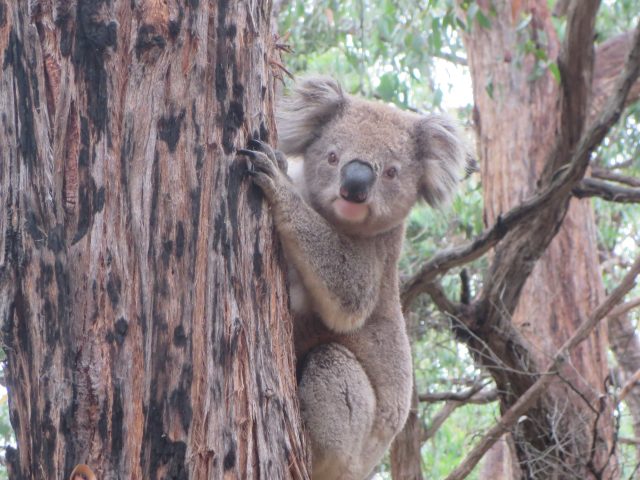
Koalas in the south west are facing a range of complex issues. Koala incidents over the past few years are ongoing and first raised national attention when koala carers highlighted horrific injuries animals sustained during logging of bluegum plantations. The animals have also suffered from over-population “explosions” in areas such as Mount Eccles/Budj Bim and Framlingham State Forest in the 1990’s/2000’s and most recently at Cape Otway, where hundreds of koalas were culled.

The map includes past survey work from a number of sources and also local sightings sent in by residents, animal carers and citizen scientists. Koala pins represent sightings or incidents concerning South West Victoria Koalas.
Please Consider Donating to this important cause (although alot of our work is based in the Strzeleckis, we are doing some support work in the south west):
https://www.melbournefoe.org.au/skat_donate
Friends of the Earth has been busy raising the profile of koalas in the south west for some time. A short summary of some of our work in regards to the South West Victorian Koala:
July 2014: Victorian Koala Issues, Plantations Forest Stewardship Council Certification 2000-2014
Feb 5 2015: Koala dropped in Blue Gum Plantation
Feb 1 2020: Koala Massacre Occurring in South West Victoria
Feb 13 2020: Koala Crisis in South West Victoria only the Beginning
Feb 9 2021: Burnt Koala Found at Portland Smelter
Feb 17 2021: Alcoa Portland Aluminium Smelter Response to FoE’s Koala Concerns
June 4 2021: Portland Koala Concerns. A Chronic and Unresolved Issue
May 28 2022: Koalas Burnt Alive at Mount Richmond National Park